Victoria Peak in Chinese: 山頂, 太平山頂 and the Names on the Signs
Home > See > Victoria Peak in Chinese
Victoria Peak is 山頂 in Chinese — 山頂 in traditional characters, 山顶 in simplified. Say it saan1 ding2 in Cantonese (Jyutping) or Shāndǐng in Mandarin (pinyin). The longer tourist name is 太平山頂 / 太平山顶, Tàipíng Shāndǐng. Both names work. 山頂 is the short word on the signs and the transport notices; 太平山頂 is what the Peak Tram operator and the Hong Kong Tourism Board print at the top of their pages.
山頂 山顶
Say saan1 ding2, or Shāndǐng in Mandarin.
Show this to a taxi driver, or type it into a Chinese-language map.
The names as they actually appear
The Chinese names at the Peak are not translations of the English ones. Each row below is the form a publisher in Hong Kong prints, in the script that publisher uses, beside the English name the same publisher prints with it.
| Chinese (traditional · simplified) | Jyutping (Cantonese) | Pinyin (Mandarin) | English printed beside it | Where you meet it |
|---|---|---|---|---|
| 山頂 · 山顶 | saan1 ding2 | Shāndǐng | The Peak | The district name in Transport Department notices (山頂 = "Peak Area"); Citybus 15 and X15 show 往: 山頂, "towards The Peak"; and the first two characters of 山頂道, 山頂廣場 and 山頂纜車 |
| 太平山頂 · 太平山顶 | taai3 ping4 saan1 ding2 | Tàipíng Shāndǐng | The Peak | The Peak Tram operator's page title and site strap; the Tourism Board's page title |
| 山頂區 · 山顶区 | saan1 ding2 keoi1 | Shāndǐng Qū | The Peak Area | The statutory planning area, in the government release approving the 山頂區 outline zoning plan |
| 扯旗山 | ce2 kei4 saan1 | Chěqí Shān | Victoria Peak | The Civil Engineering and Development Department's place-name glossary, printed against the peak itself; still in use on AFCD hiking pages in 2026 |
Two of those are official names for the same hill. The Civil Service Bureau's translation glossary gives both 太平山 and 扯旗山 for "Victoria Peak", and the place-name glossary prints 扯旗山 against the peak's own coordinates. Neither is a mistake.
What decides which one you say is who is listening. The Transport Department, Citybus, the tram operator and the Tourism Board all print 山頂 or 太平山頂, and 扯旗山 does not appear once across the four of them. Say 山頂 at the Peak; recognise 扯旗山 when it turns up in government or hiking material.
A fourth name sits in a different register again: 爐峰, which the AFCD uses in trail names such as 爐峰自然步道, and 爐峰峽 for the saddle. You meet that on a country-park signpost, not on a destination board.
On the tram, and at its two ends
The Peak Tram is 山頂纜車 · 山顶缆车 — saan1 ding2 laam6 ce1, Shāndǐng Lǎnchē. That is the name in the operator's own navigation and page titles, and the simplified form is the one it uses in the name of its WeChat account, 香港山顶缆车ThePeakTram.
Each end has its own name on the ground:
- 中環總站, the Central terminus at Garden Road. The operator also calls it 花園道總站, and the Transport Department's bilingual notices label it 下山頂纜車站 — "Lower Peak Tram Station", which is what a bus sign says.
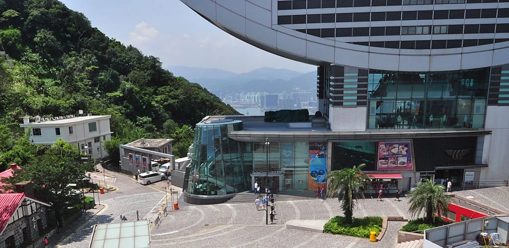
- 山頂總站, the Peak terminus, inside the Peak Tower. The government's district page puts it as 到達位於凌霄閣的山頂纜車總站 — arriving at the Peak Tram terminus at the Peak Tower.
The two Citybus routes are not the same trip in Chinese either: 15 shows 往: 山頂 and 15C shows 往: 花園道, because 15C runs only between Central and the Garden Road terminus.
The neighbouring names you will meet on the same trip
Every one of these is printed by the operator, the Tourism Board or a government department, in both scripts.
| Chinese (traditional · simplified) | Jyutping | Pinyin | English | What it is |
|---|---|---|---|---|
| 山頂凌霄閣 · 山顶凌霄阁 | saan1 ding2 ling4 siu1 gok3 | Shāndǐng Língxiāogé | The Peak Tower | The building over the tram's upper terminus. 凌霄閣 alone — ling4 siu1 gok3 — is where the tram ends |
| 凌霄閣摩天台428 · 凌霄阁摩天台428 | ling4 siu1 gok3 mo1 tin1 toi4 | Língxiāogé Mótiāntái | Sky Terrace 428 | The ticketed deck on the Tower's roof. The Tourism Board prints the shorter 摩天台428 |
| 山頂廣場 · 山顶广场 | saan1 ding2 gwong2 coeng4 | Shāndǐng Guǎngchǎng | Peak Galleria | The mall at 山頂道118號, across Peak Road from the Tower |
| 盧吉道 · 卢吉道 | lou4 gat1 dou6 | Lújí Dào | Lugard Road | The contour road round the Peak, and the harbour walk on it |
| 柯士甸山道 · 柯士甸山道 | o1 si6 din6 saan1 dou6 | Kēshìdiàn Shāndào | Mount Austin Road | The road up to Victoria Peak Garden |
| 夏力道 · 夏力道 | haa6 lik6 dou6 | Xiàlì Dào | Harlech Road | The other half of the Peak circle walk, from Lugard Road |
| 山頂道 · 山顶道 | saan1 ding2 dou6 | Shāndǐng Dào | Peak Road | The road between the Tower and the Galleria, and the address of both buildings |
Victoria Peak Garden carries two Chinese names in official use: 山頂花園 in the Leisure and Cultural Services Department's facility data, and 山頂公園 on the Tourism Board's page in traditional characters, 山顶公园 on the same page in simplified. Either one on a map means the garden.
What to say, and what to type
For a taxi, the word is 山頂. It is what Citybus paints as the destination on routes 15 and X15, it is the word the Transport Department uses for the district, and a Hong Kong driver hears the Cantonese reading, saan1 ding2, not the Mandarin one.
Into a Chinese-language map or search box, four strings cover the whole trip: 山頂 for the Peak, 山頂凌霄閣 for the Peak Tower, 山頂纜車 for the tram and 山頂廣場 for the Galleria.
At the Garden Road end, the taxi stand sits in 纜車里 — Tramway Lane, the lane beside the lower terminus. That is the place-name a driver will know for the rank at that end of the line.
The railway will not get you there: the MTR's own open-data station list has 273 rows across its lines and 98 distinct stations, and not one of them is 山頂 or 太平山. What the official routings give instead are MTR exits — 港鐵中環站 J2 exit for the Garden Road terminus, and 港鐵香港站 D exit for bus 15 or X15 and E exit for green minibus 1.
The confusions worth clearing
The English name is not how the Chinese one sounds
山頂 reads "The Peak" on a sign, not "Shan Ding". 山頂道 reads Peak Road, 山頂廣場 reads Peak Galleria, 盧吉道 reads Lugard Road and 柯士甸山道 reads Mount Austin Road. Those four pairs are printed side by side in one bilingual Transport Department notice, Chinese on one page and English on the other. 凌霄閣 reads The Peak Tower on the tram operator's own pages and on the Tourism Board's. Either way, the English name on a board tells you nothing about the sound of the characters above it.
太平山街 is not the Peak
"Tai Ping Shan" in English is 太平山街, Tai Ping Shan Street, in Sheung Wan at the foot of the hill — the old 太平山 district, a street rather than a summit. The Peak is 太平山頂, with 頂, summit, on the end. A map that sends you to Tai Ping Shan Street has you at the bottom, looking up.
太平山 is the hill, 維多利亞港 is the water
維多利亞港 · 维多利亚港 — wai4 do1 lei6 aa3 gong2, Wéiduōlìyà Gǎng — is Victoria Harbour, the water you are looking down at. One official sentence carries both names: 在山頂居高臨下,可俯瞰維多利亞港及港島南區, from high on the Peak you look down on Victoria Harbour and the southern district of Hong Kong Island. 太平山 is what you stand on; 維多利亞港 is what you see.
山頂 means "hilltop" everywhere else
In general Chinese 山頂 simply means the top of a hill, and a dictionary gives that as its only sense. The Peak meaning is Hong Kong's own — the name of the district, the tram, the road and the mall.
See also: where Victoria Peak is and what the name covers; the history behind the Chinese names; getting to the Peak; the Peak Galleria, 山頂廣場, and its free deck; and the way back down, and what to say going back.
Sources, all read 16 November 2026: the Peak Tram operator in Chinese (thepeak.com.hk/zh-hant); Hong Kong Tourism Board in traditional and simplified Chinese (discoverhongkong.com/tc and discoverhongkong.cn); Transport Department bilingual traffic notices (notice index_id_88755); Citybus route search; the Civil Engineering and Development Department's Glossary of Place Names; the Agriculture, Fisheries and Conservation Department's country-park and hiking pages; the Civil Service Bureau e-Glossary; LCSD facility data; a 2008 government release on the 山頂區 outline zoning plan; the Antiquities and Monuments Office heritage trail; Hang Lung Malls for 山頂廣場; MTR open data. Jyutping and pinyin readings are composed per character from the Unicode Unihan database.